Optimizing Walking Routes for Safety at UT Austin
The area around the University of Texas at Austin has seen an uptick in crime in recent years. roUTe is a product idea I devised during Convergent’s spring 2020 build season. The idea is to build a data-driven mobile application that optimizes walking routes for safety in the UT Austin area. This repository holds my code for a route optimization algorithm I created that would drive the backend.
How it works
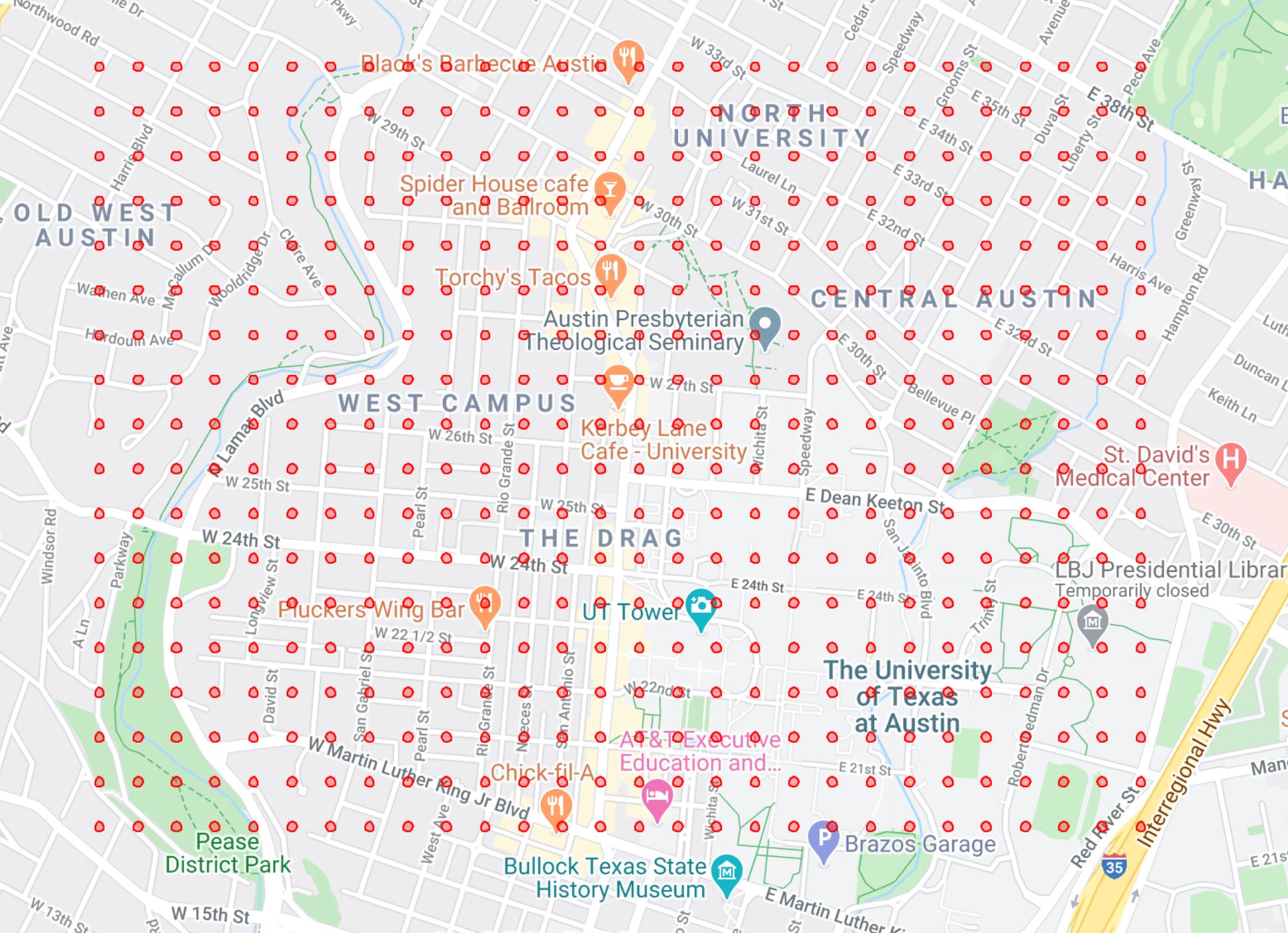
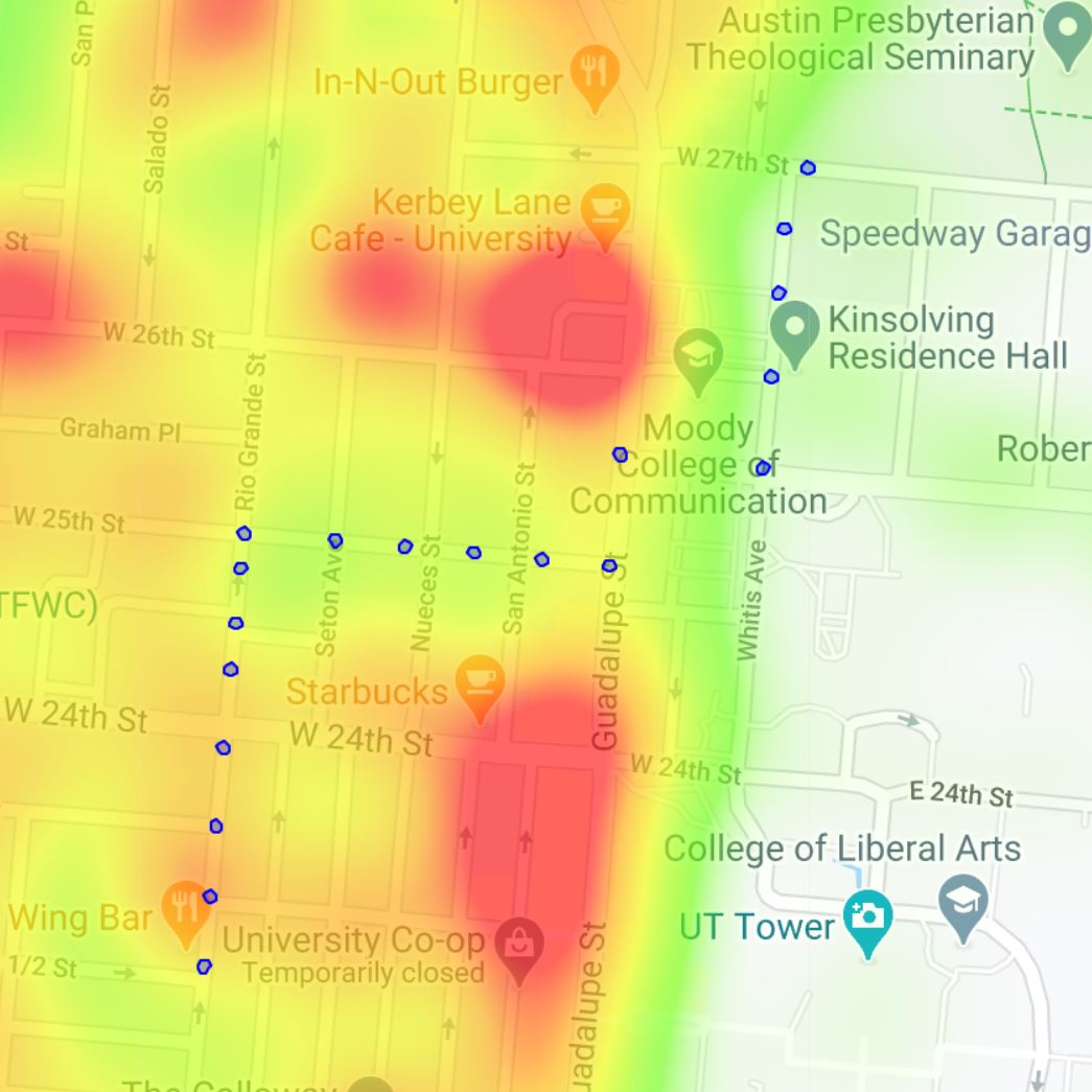
We start with a user location and destination. This information is fed into a waypoint generator. A waypoint is a latitude-longitude coordinate that a route is directed through. These waypoints are fed into the Google Maps Directions API and roUTe generates up to 15 unique routes. Then, roUTe extracts nodes from these routes, calculates intermediate points between each node, and generates point routes. Each point in every point route is mapped to a latitude-longitude subregion, shown below as red circles. All crime data from the last 4 years is pulled from austin.gov using the Socrata Open Data API, each crime is weighted based on severity, and each sub-region is scored. Then, each point route is scored 90% based on the sub-regions it passes through and 10% based on route duration.